
Kilometers 70 -62
It was an early morning for those of us going via the beach access North Bound from Thrasher Cove. Tides were in our favour. The tides were going out in the morning, with low tide, 0.3 m, at 9:59am. High tide, 3.5 m, would be at 4:20pm
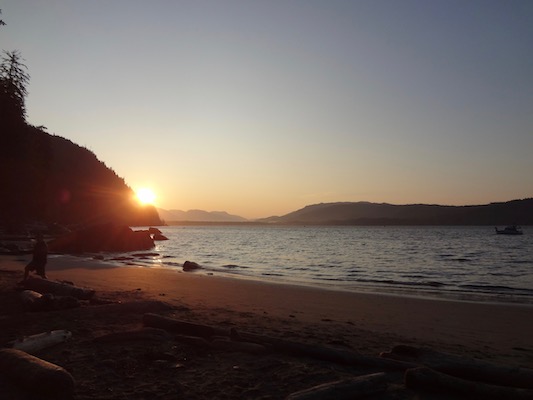
The day would be about boulders, crazy surge channels, mud beyond belief, landscape like no other and of course ladders…. all while being mindful of the tide.
Let’s talk about boulders. It isn’t one pile of massive rocks. Once you get over there is another one waiting for you.

Sometimes there are massive piles of driftwood among them.

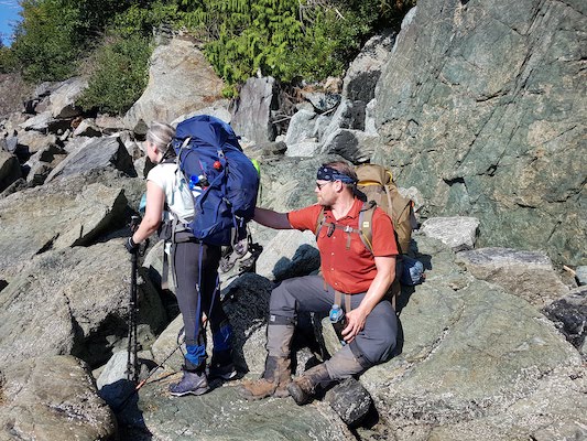
Some of the boulders are covered in barnacles. I wore biking gloves with grips that I picked on sale at MEC. These protected my hands well, without impeding me, though they were hot at times. One of the dear Double As gauged the centre of her palm, which she had to bandage for the rest of her hike to prevent infection.
Some of the rocks are full of tidal pools. These are pretty and fun, when you have time to stop. They can be deep and the rocks are very slippery too. I turtled among a slippery set and was thankful for the cushion of my pack. One of the engineers effortlessly pushed me up right. I think it was here that I may have smashed my pick toe, but I didn’t notice until later at camp.
Spoiler Alert: It was also among one of these boulders where my hiking partner, D, slid. It was this slide that cause a chain reaction that inevitably led to his evacuation.
A rock and a hard place. Shortly after the engineers passed us, we heard them making a ruckus. Yup, they came upon a bear among particularly large rocks between the ocean and thick steep forest. They managed to scare the bear into the forest. As we passed through making as much noise as possible, we could hear it in the brush beside us.
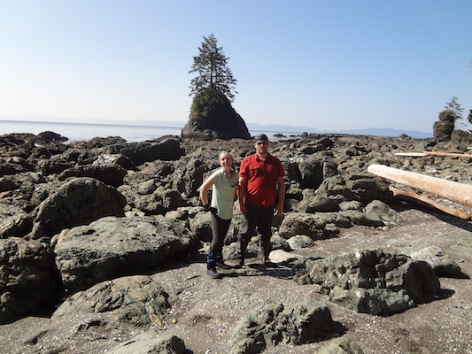
Reaching Owen Point marks the end of boulders and the beginning of the sea shelf walk. Owen Point also marks the place where the trail is no longer parallel to the land on the other side of Port San Juan. In the distance you can see the Olympic Peninsula of Washington State.
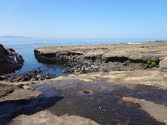
The sea shelf landscapes are like no where else. Each section unique in ways that need to be experienced.

My favourite parts were “a hole through under t the rock” and the waterfall. Thought I could slide under that log with my pack. Nope!

Wish we could have stayed here.

After this moment to cool off and replenish our water we had the sea surges to contend with. These I could have done without. Some could be easily crossed. 3 stood out to me. One required going up and around. The top slopes down toward the crashing surge below. It was a bit slippery even on this hot day, and there was an old rope bolted to the rock to hold onto, but it isn’t taught and the strength could not be depended upon. The rope led to narrow steps of mud and roots and then back out to the sea shelf.
It was very helpful to have 4 people for another surge, us and the Double As. There were large boulders wedged in the crevasse. Two of us went down and across. Then we passed all the packs across like a daisy chain. The last surge channel that concerned me was only passable for me because D was there. D at 6′ could simply walk across, but for me at 5’1″, the crevasse was too wide. I took my pack off and D brought it to the other side. Even still, because the edges sloped downward to the raging surf, I didn’t feel that I could get a steady landing on the other side even with a hop. D straddled the surge and I thought he was going to help me hop across, but instead he picked me up and placed me on the other side.
By this time I was concerned for the incoming tide and a little nervous for even more challenging surge channels. We decided to find beach access B, marked with dangling buoys. The ladder up was steep.
***
When I first wanted to do the WCT as a teen, my Mom told me that I would have to climb cliffs with knotted ropes. It was along the beach access B ladder that there appeared to be a dangling knotted rope. Perhaps from times gone by.
***
On beach access A. I really wish we had stayed on the shelf onwards to Beach Access A. I learned that there were no more wild surge channels and it would have saved us about 2 km’s of mud.
***
At the top of the Beach Access B, there was a lovely clearing. D and I stopped there to have snacks, while Double A carried on. We chatted with a muddy group of women going South bound. They had been on the trail during the largest rain storm in 10 years.
It was in this clearing when D shared with me that his slip in the boulders was starting to cause discomfort.
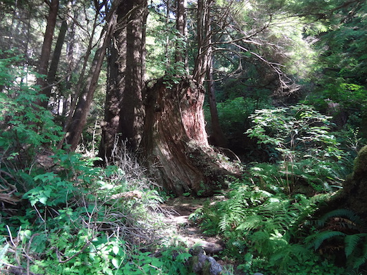
The remaining 4 km to Campers was lush and muddy.
Fun Fact 1: The above photo shows a Nurse Tree. A nurse tree is a large, old tree that young trees grow out of.
Fun Fact 2: One rarely see kilometre markers on the trail.

One thought on “West Coast Trail – Pacific Rim National Park – Day 2: Hike”